UPDATE: I ended up adding two more days and one night to the trip when we returned to the South Island, riding from Picton where the ferry landed, through to Patons Rock. This included the longest ride I’ve ever done in one day of 192km. Skip to the bottom to read these updates!
I’ve been slowly building up to a multi-day bikepacking adventure, first with some test runs on an eBike, then building a new bike specifically for bikepacking, and then taking that bike for a couple of overnight test runs, including this one to Little River, however all of this was really practice for the real deal – a desire to ride multiple days self-supported and camping.
With a family Christmas and New Years planned for Levin in 2022, the perfect opportunity presented itself for me to ride my way to Levin via “the long way” whilst my wife and kids spent time with family in Taupo and Levin. Itching to get started, I planned out the route on the lower third of the North Island section of The Tour Aotearoa but done in reverse, seeing me start in Wellington, follow the route to Whanganui before hooking south to Levin:

Plugged into my Garmin Edge, this would look a little more like this:

Key Stats
Trips can be summarised in many ways, but here are the key stats from this first multi-day bikepacking trip (updated to reflect the additional 2 days I did in the South Island)
- Days:
68 - Nights:
5(45 in the tent, 1 at my Uncle and Aunty’s house) - Distance:
591.85km819.78 - Elevation:
5,266m7,513 - Punctures: 0
Of course, a trip entails a lot more than just numbers, so below is a very brief summary of each day of the trip. As this is a pretty long blog post, I’ll put some hyper links here so you can skip to the days if you’re interested:
- Day 1: Wellington Ferry Terminal To Upper Hutt
- Day 2: Upper Hutt To Masterton
- Day 3: Masterton To Palmerston North
- Day 4: Palmerston North To Rangiwahia
- Day 5: Rangiwahia To Whanganui
- Day 6: Whanganui To Levin
- Day 7: Picton to Havelock
- Day 8: Havelock to Patons Rock
Day 1: Wellington Ferry Terminal To Upper Hutt
- Moving Time: 1hr 53min
- Distance: 38.91km
- Elevation: 144m

The trip started with a dreary departure from Christchurch and a 4hr drive to Picton to catch the ferry. As I was fuelling up in the rain the Queen song “Bicycle” was playing on the forecourt:

Bicycle, bicycle, bicycle
Queen “Bicycle”
I want to ride my
Bicycle, bicycle, bicycle
I want to ride my bicycle
I want to ride my bike
I want to ride my bicycle
I want to ride it where I like
It seemed as good an omen as any, and with the car fueled, the kids fed and the open road ahead we drove continuously to Picton where the sun was shining and soon we were on the ferry and heading north to Wellington
Arriving on a beautiful day in Wellington, I was anxious to get cycling so as we pulled off the ferry I spied a handy location to get loaded and soon the trusty stead and what I hoped would be a faithful companion for the next few days was locked and loaded:

The only section of the first couple of days that really had me a bit nervous was the very first ride up to Petone alongside the motorway. The official guidebook had indicated it was possible to just ride along on the side of the motorway, but that was coming north to south – I didn’t really fancy heading north into the face of the motorway traffic on verge, but unfortunately the only alternative was a 60km alternative route. In the end, whilst I started on the verge of the motorway following the official GPX route, I did spy a rough and ready pathway between the motorway and the railway line which I jumped over the motorway barrier and rode on that for most of the way.
At the end of a slightly hair raising few kilometers, I was in Petone and knew it would be a gentle ride up the river to the campsite from there.

The Hutt River provided the backdrop for the remainder of the trip on Day 1 as I followed a really nice and developed river trail all the way through Lower Hutt up to Upper Hutt and a night in a secluded corner on the freshly mown grass at the Wellington Kiwi Holiday Park.


It was threatening rain so I pitched the tent quickly, showered and cooked a nice meal before bedding down for the night. A local possum screeched and squawked throughout the night at close proximity waking me regularly, ensuring I’d start my first full day with a depleted sleep tank!
Day 2: Upper Hutt To Masterton
- Moving Time: 6hr 35min
- Distance: 115.94km
- Elevation: 925m

Waking early with a tent damp from a heavy dew, there was no choice but to roll it up a bit wet, stuff it away and then head off for an early breakfast at a local Subway before tackling the (in)famous Remutaka Hill … although I’d be going on the awesome Rail Trail and not the motorway. This trail proved to be an absolute highlight of the entire trip, and after a short section of 16% incline to waken the legs, it was a pretty steady and gentle climb to the top, going through some beautiful (and dark!) tunnels and magnificent bridges:
One of the other highlights was the “Siberia Bridge” swingbridge across a deep gully – fun on a bike, but with a tragic history where a train was blown off the railbridge and killed four children:


The descent down the backside of the hill was fun, capped off by a section of singletrack that, whilst slightly overgrown, was a heap of fun and I was stoked at how well the bike performed even loaded up. I detoured slightly to Featherston for a morning tea, before marching on down to the historic Martinborough for a proper lunch:

With the weather starting to hint that rain was on the way, I polished off the lunch and headed off towards the south-east, again taking “the long way” to my destination of Masterton, this time via gravel roads and Gladstone. Sure enough the rains opened and out came the wet weather gear which was stashed primed and readied for such an occasion on the outside of my front handlebar bag. The rain lasted for around 90mins and eased up just as I was heading into Masterton. One interesting experience was meeting a German couple on Riese & Muller eBikes next to a river ford I’d just crossed. Owning two Riese & Muller eBikes myself, I was delighted to learn they were riding the TA (Tour Aotearoa) on them and the woman was in fact the NZ sales rep for R&M. She was delighted to meet a customer!
With the rain clouds gathering again, I pushed on towards Masterton and I quickly checked in at Mawley Park campground and pitched my tent before the heavy clouds opened again and the rain really set in:


I tried in vain to dry some clothes with a makeshift clothesline inside my tent, but to no avail and the rain didn’t let up all night, leaving me pondering the prospect of a wet set down in rain. Overall, I was really pleased with how the first “big day” went, over 100km and varied weather and all my gear had performed well and my body felt fine.
Day 3: Masterton To Palmerston North
- Moving Time: 6hr 4min
- Distance: 110.13km
- Elevation: 1,178m

Packing down in the pouring rain was honestly no fun, and being soaked through before a 1km was completed was not an ideal start to the day, but this was always a chance and given I had no choice but to push on, that’s precisely what I did. It was a quiet and somber ride to Eketuna for the first stop of the day:


Despite the rain, the route took me through some lovely desolate valleys that meandered through farming countryside and, alone with my thoughts, I did consider how fortunate I was to be here and doing this. After so much planning, to be “mid-adventure” was something worth pausing and being grateful for:

As I approached Pahiatua, the rain started to ease up and with the prospect of one big hill climb left, up and over the infamous Pahiatua Track. Again, and now it was starting to become a bit of a standing joke, the route took me over a far more circuitous route, finding a steep, rutted gravel track – one that was devoid of cars for sure, but certainly harder to power up compared to sealed roads. I could see the destination clearly however, with the powerful energy generating wind turbines at the top of the hill:

What goes up, must come down and after grinding my way to the top, I enjoyed an absolute belter of a descent on perfect roads, Strava telling me I averaged 45kph on a 5km descent – not bad fully laden!
After a day of rain, nature had one more trick up her sleeve for me – screaming down the final descent into Palmerston North at ~50kph, a bee hit my head between the air vents on my helmet and promptly stung my head! It would go on to be a painful reminder for the next few days of the trip that there are some things I just can’t plan for!
I was super pleased to be staying with my Uncle and Aunty in Palmerston North, as it gave me a chance to dry my gear, wash some cycling clothes, and sleep in a comfy bed and enjoy the company of family. This was the first time I’d completed back to back 100km+ days and, whilst tired, I was happy with how everything was ticking along.
Day 4: Palmerston North To Rangiwahia
- Moving Time: 6hr 58min
- Distance: 102.79km
- Elevation: 1,348m

Whether it was accumulated fatigue, not having a great sleep even though I was in a real bed, or just the knowledge that this was going to be a day of steady climbing, I didn’t feel all that great as a I pulled out of Palmerston North after a late start saying farewell to my Uncle and Aunty with a cooked breakfast of bacon and eggs to fuel me on my way.
I quickly found the Manawatu River which would be my guide for the first few kilometers of the trip:

From there it was on to Ashurst and a quick drink as it was already turning into the hottest day so far. Gravel tracks replaced the smooth seal, and soon I was in the middle of nowhere, zero cell phone coverage and a long day in the saddle ahead. I stopped at the small community of Pohangina and found some shade for a drink and rest from the heat. As I restarted I was hailed from a parked campervan in a rest area asking if I wanted a drink! I called back saying I’d just had one and carried on my. Shortly after, the van overtook me and when I stopped at an intersection it pulled up alongside me.

Out of the campervan jumped “Trail Angel Mary” – a volunteer helper who immediately expressed concern that I was on the wrong track for the TA (Tour Aotearoa) and I should have turned left rather than right at the at earlier intersection where she overtook me. After some discussion, it appeared I was on an alternative route that would bypass some gravel (honestly, at this stage I was thankful) and Mary and I chatted for around 20mins after she offered me a cold coke and a banana!
It was lovely to have this sort of support on a tough day, but I knew that every minute I delayed would push out already a long day. A series of continuous climbs and descents followed each other, and with the heat really ramping up I was starting to get nervous around my water supplies. Given recent rain, most of the rivers I’d passed were running brown and even with a water filter, I was not keen to top up from those. I was at the point of rationing my water and considering stopping in at a farm house for a top up, when I spied the Pohangina Base Camp DoC (Department of Conservation) centre where a couple of staff were mowing the lawns and cleaning the hut. They were more than happy for me to fill up from their water tank which required boiling as was rain water from the roof, but I ran it through my portable water filter and it was fine:

I chatted for 20-30mins to the young worker there as we exchanged stories and this was something I really enjoyed about this trip – just meeting new people and hearing their stories. With my water bottles refilled, I was conscious there was still quite a bit of cycling to go before I go to my destination so pushed on, no longer worrying about running out of water.
With the grit and grime of gravel in my mouth and on my clothes, I pulled into the Apiti Tavern just after 4pm opening time, quickly ordered drinks and dinner and sat down in the shade to rest up – I was spent. Out the back of the tavern there was some interesting local art work, including these lifesize Moa:

Deep in the hurt locker, I admitted to the barman:
I think I left a little bit of my soul out there on those hills today
He offered cheap accommodation out the back if I could not push on to Rangiwahia, however, fortified by an hour of rest and a solid dinner I decided to push on for some early evening riding and I am so glad I did. It turned out to be some of the best conditions of the entire trip, with clear blue skies, sparkling evening sun and the final 20km and 350m elevation (punctuated by two epic descents into a deep gorge with a correspondingly slow grinding out and up the otherside) produced some awesome scenes:


I rolled into the Rangiwahia Domain completely spent after a long, hot day where I didn’t quite get my rest breaks and fuelling strategies right and paid the price. A couple of young American lands from Michigan and Minnesota were already there, doing the full TA from north to south, and shared their own tale of a big day of climbing coming in the opposite direction. Whilst I commiserated with them, I secretly delighted at the prospect of a day of descents for me tomorrow if their stories were anything to go by!
With the tent pitched, showered in the surprisingly awesome and clean $2 shower, we exchanged stories for a couple of hours before heading to bed. My third straight day of 100km+ and I was exhausted, wondering how the following day would play out.
Day 5: Rangiwahia To Whanganui
- Moving Time: 5hr 56min
- Distance: 109.19km
- Elevation: 1,076m

Despite the big day, I found it hard to fall off to sleep, and slept only fitfully waking early and getting cracking with breakfast and pack down. Despite the fine weather overnight, there was a very heavy dew and it was impossible to pack the tent up without it getting wet. However, all tasks were done, I farewelled the Americans and wished them luck before setting off on some exhilarating downhills which got me excited about an easy day of riding to the river town of Whanganui. Whilst this was a promising start there ended up being rolling hills all day, meaning it was another 1000m+ elevation day.

It was clear blue skies from the outset and remote roads left me to my thoughts as I wound my way through gorgeous countryside with the coast my final destination for the day. I stumbled across a paddock of deer who looked at me curiously before scampering away to safer grounds. The hilly countryside was very different to the South Island where I live and I enjoyed the unique cloud formations as well.


I had a “second breakfast” at the small town of Hunterville before hitting more gravel backroads. It was getting really rather hot and wearing my high-vis vest was not allowing the heat to leave my body easily and I quickly felt pretty fatigued. In a small valley in the middle of nowhere I started looking for shade to have a rest. I saw a farmer working on the roof of his farmhouse and asked if he would mind if I lay down in the shade of his tree on the frontlawn – he was fine with it!
I stripped off my backpack with my water bladder in it, rested my head on it, and closed my eyes, cooling off and briefly drifting off to sleep! Refreshed 30mins later, I carried on riding with the aim of getting to Whanganui, the biggest town since I left Palmerston North and dreaming of an Indian curry for dinner!

My final stop before hitting Whanganui was a small, petrol station at Fordell where I got a cold coke and caught my breath:

With a final 15km push into Whanganui, there was time for a few more rolling hills to sap my energy levels before a quick downhill ride to the historic Durie Hill Memorial Tower and Elevator, which provided a great view of the city:


A lack of attention to detail on my side meant I had not realised that the Whanganui Top 10 Holiday Park I was staying at was actually 7km out of the city centre up the far side of the road. With my mind on that curry, and legs that had already done 100km, it was a tough pill to swallow to grind slowly up the river to the campsite. On arrival, I dried my tent in a warm wind, showered and ordered Uber Eats Indian delivery!

450km in 4 days and I was exhausted – and happily, had an awesome sleep in my tent. A great day, and my trip had only one day remaining.
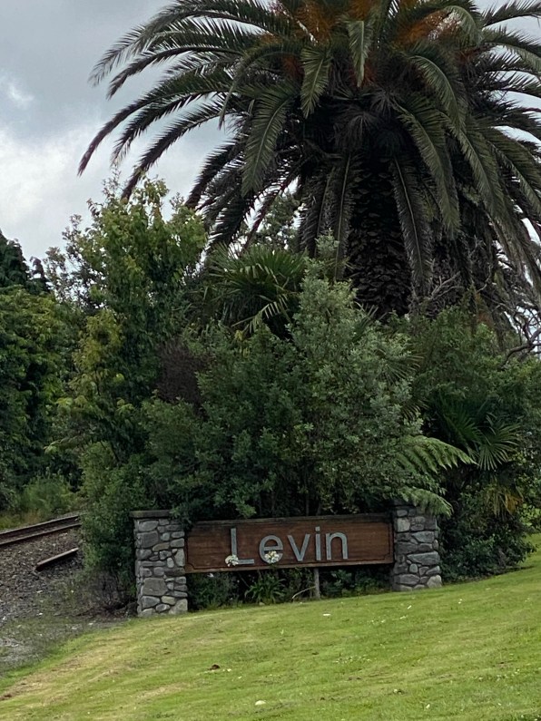
Day 6: Whanganui To Levin
- Moving Time: 5hr 40min
- Distance: 114.89km
- Elevation: 595m

Waking from an excellent sleep made a huge difference, as did dry ground, so for the first time in my trip I packed my tent down dry and headed into the historic Whanganui city centre for a Subway sandwich to power my final day on the bike. At this stage, I was departing from the TA route, and beelining for Levin – as it was December 24th, Christmas Eve, I had to be home before Christmas!
The day started with backtracking to Fordell before cutting across to State Highway 3. The views, as always, were beautiful with the infinite array of clouds always capturing my attention:

After initially planning a route to take me on the backroads, the combination of fatigue, heat and desire to be at my destination meant I changed my plans and stayed on SH3 before turning onto SH1 later in the day.

I parked up next to the town mascot in Bulls for my first break, having an early lunch approximately halfway. It was a warm day, and I had decided to strap my high-vis jacket to my rear drybag for additional visibility as it was simply too hot to be wearing it given its poor breathability.
Despite being on two busy highways on Christmas Eve, there was generally a pretty generous shoulder to ride in and I had no problems with cars giving me ample space when overtaking. By nature of being highways, there was a need to pay real attention and also less scenic things to view and I was focused on getting to Levin. A quick refuel of a pie and coke at Foxton and I was only 14km from my destination:
I’ve written elsewhere about how much I love my Garmin Varia Radar and taillight and on a day like today, it proved its worth all over again, telling me to pull over as cars approached from the rear. It also counts the numbers of cars that pass you, totalling over 1100 on this day – a stark departure from the deserted roads I’d been riding the previous five days:

I pulled into my brother and sister-in-laws house to a relatively deserted house – the majority of the four families staying there for Christmas were out on a walk, so I had a chance to shower and clean up first. My bike did so well, I was thrilled:

6 days done and dusted! This ended up being a pretty easy day – only half the elevation of previous days, sealed roads the whole way, and a light tail or side wind for much of the ride.
Conclusion
6 days and 5 nights of riding and everything went pretty much how I expected. There were some tough days, some brilliant riding experiences, plenty of “Solo Sam” time which I enjoyed and I was so pleased with how all my gear had performed. As anyone will tell you, the planning and research is half the fun, but at some point you actually need to start an adventure. Having got a start, this trip just took on a life of it’s own and I was along for the ride.
I felt I could definitely have continued on further biking, but was also nice to arrive on Christmas Eve, knowing a few days of quality family time and rest were ahead.
My next plan is to bike a couple of days in the South Island from Picton when we get off the ferry, to Nelson and then on to Golden Bay.
Day 7: Picton To Havelock
- Moving Time: 1hr 52mins
- Distance: 35.68km
- Elevation: 475m

It was an early departure from Levin to get to Wellington to catch the ferry in time to return to Picton. After a really pleasant ferry ride, we disembarked, I grabbed a few food supplies from the local Four Square supermarket, and loaded up the bike for what was going to be a short ride through to Havelock:

My wife dropped me at a local park where I had lunch and then packed up. My original plan had been to ride through to Nelson but given we were not off the ferry until after 1pm I didn’t fancy doing 110km that late with some significant climbing, so opted for a shorter ride to Havelock.

This route took the scenic ride through Queen Charlotte Drive and there was plenty of evidence of recent rain and flooding as there were mutiple slips in the surrounding hills and places where the road had been washed out and reduced to one lane. There were many beautiful bays that I went through as well:


With a weather warning in place for heavy rain, I pushed on to the scenic Havelock and pitched my tent with some ominous clouds in the distance. I grabbed some dinner and then took a walk around the beautiful marina before settling in for the anticipated overnight rain.


Sure enough, the rain came in around midnight and continued heavily, although eased off a little in the morning allowing for a relatively uneventful pack up (nothing compared to the rain in the morning in Masterton on Day 3!
Day 8: Havelock To Patons Rock (The Longest Day!)
- Moving Time: 10hr 53min
- Distance: 192.25km
- Elevation: 1,772m

After a quick pack up, the tent was wet and I donned the wet weather gear from the outset and started what was planned to be a ride to Richmond to stay with a mate. The original plan was to ride over the Maungatapu Track as a “short cut” (albeit, with a very large hill in the middle) but I was having second thoughts about this given the wet weather and low cloud. Ultimately, the decision was made for me when I checked and the track was closed due to previous heavy rainfall in the area:

This meant I would need to ride the longer way around the Rai Valley, but did afford an opportunity to stop at the delightful Pelorus Bridge cafe for a “second breakfast” and also pick up a filled roll for later. Given how wet it was, there was not a lot of opportunities to get photos on my phone but it was a day of drizzle and very low cloud:


At one of the climbs exiting the Rai Valley, the rain was coming down so hard I could see streams of water coming down the steep road incline – a first for me! Having made rapid progress to reach Nelson around midday, I decided to undertake a bold plan – could I bike all the way through to Patons Rock in Golden Bay in a single day? I knew this would be as much a mental challenge as a physical one but having settled on it, I had a quick rest and lunch in Nelson and then embarked on the route to Motueka following various cycleways initially and then the Coastal Highway.


Rolling into Motueka at 4pm, I knew the hardest part of the day was still to come – the Takaka Hill! I had a 45min rest, ate a subway, charged my Garmin Varia and then set off in the rain for the 15km, 1,100m climb with an average grade of 8%. Doing some quick math, if I was to grind up at ~8kph based on that gradient, it might take me a couple of hours just to complete the climb – and so it proved, reaching the summit in the rain around 7:30pm. It had been a very eery climb – with thick, low cloud I could see virtually nothing of the surrounding valleys and yet it had been remarkably peaceful too.


There was little left for me, but to check the brakes and then barrel 8km down the other side in the heaviest rain of the day! It was too heavy to wear glasses to keep the rain and wind out of my eyes, and given the slippery roads, the decent was mainly in the 30-40kph speed range. Getting to the bottom there was still another 20km to Takaka, followed by a remaining 10km to Patons Rock to complete. With the rain and low cloud night set in early, so my dynamo powered light at the front was critical, as was the trusty Garmin Varia blinking away at the rear and warning me of approaching cars from behind. I also put on my reversible high vis jacket in “night mode” so I had a highly reflective appearance.
To some extent, I had been anticipating the final flat ride into Takaka to be the hardest, with the accumulated fatigue and the relatively boring nature of the ride, especially in the rain. As it transpired, I had plenty of energy and the final kilometers ticked away happily as I reflected on my longest ride on a bike ever. I was pretty proud of myself in terms of the effort required and the mental focus needed – this was 77km than my previous longest ride from earlier on this bikepacking trip.
This concludes my bikepacking trip – a really great experience, some definitely challenging moments, but some super happy ones too. Now that I know what this bike (and myself!) are capable of, I’ll definitely be planning some more!